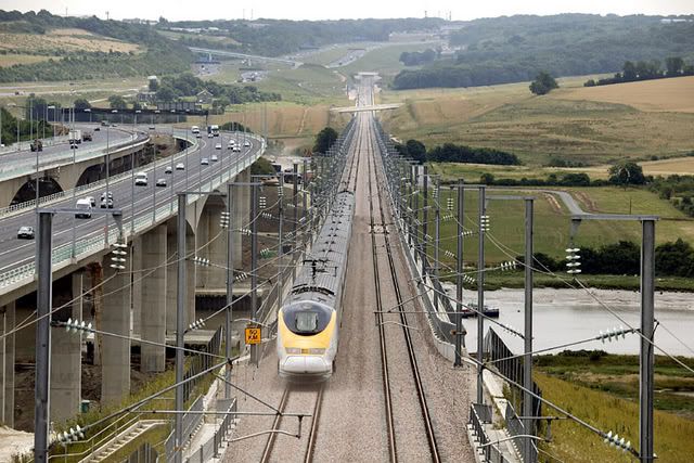
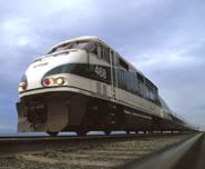
Burning the Midnight Oil for Living Energy IndependenceNote This is a repeat of one of my train diaries from 2007 that I wish to add into the Sunday Train knowledge base. Unless there is major rail news in the next week, Sunday Train next week will be considering the limitations inherited by the recent SubsidyScope report on Amtrack subsidies that they inherited from an uncritical acceptance of the limitations of traditional mainstream marginalist economic theory.The big knock against high speed rail is, of course, that it does not run
door to door. This is, of course, why the passenger air transport market is such a strategic target ... it is an existing fuel-inefficient mode of transport where everyone travels as a pedestrian. And a well designed high speed rail system will deliver the target market among pedestrian travellers from as close or closer to their origin, and drop them off as close or closer to their destination.
But those are not the only passengers that HSR will be catering to. A term I have heard railfans use for this type of activity is "recruiting" patronage, so, after the fold, I step through some of the important current, and potential, recruiters.
 Ubiquitious Marginal Recruiter: Da Car
People today in the US normally get to the airport by car, so the first reaction of most people in the US when an airport-substitute becomes available is going to be to drive there.
This means that substantial parking will need to be provided in the vicinity of
any outer suburban HSR station, for traditional park-and-ride use of the station.
However, we should never look at a fuel-efficient mode of transport, decide a strategic core market, and then
stop there! A substantial benefit of high speed rail is that it brings rail outside of the inner-metropolitan core and through the outer suburbs, where a high speed rail stop can act as a support to a wide range of pro-Energy-Independence local transport.
In the balance of this piece, I am going to assume that about half of the eighth-of-a-mile zone surrounding the HSR station entrances will be devoted to the car ... access, egress, and parking. Often this will be two-level parking with covered walkway access directly to the station, making it easier for the individual park-and-ride users to avoid getting killed by the other park-and-ride users as they access and egress the station parking.
Hopefully, as the mode share of private vehicle use declines over the next two decades, some of the space devoted for car parking can be recaptured for a more intrinsically useful purpose.
Core RecruitersThere are a number of established transport technologies ... though not all of them established
in the United States
in this particular role ... that are inclined to act as very effective recruiters for a High Speed Rail station, because HSR provides them with an effective complement for the local transport services that they provide.
The five that come to my mind are walking, bicycles, neighborhood electric vehicles, local buses, and local rail (of all sorts).
Core Recruiter: Shanks Mare 
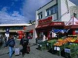
The first recruiter is the transport mode called "Registration 11" in Grenada and what by those running the railroads of Oz are mostly thinking of as "self loading freight" ... that is, pedestrians.
The appeal of pedestrians is that they are a core market. A very large number of the people who rely heavily on foot power to get around locally will have a strong preference for the train over any other form of longer distance travel ... so market penetration by the high speed rail service among pedestrians living in the vicinity of a high speed rail station will be very strong.
On the other hand, it would seem as if we could disregard pedestrians in outer suburbia, because
nobody in outer suburbia lives within walking distance to anywhere ... ... well, at least, practically nobody (after all, a handful live in small towns that have been swallowed up by outer suburbia).
In urban settings in Oz, where more people are accustomed to walking a few blocks, the high intensity pedestrian recruiting range for a train station is taken to be about a quarter mile, with a lower intensity recruiting range of just over 0.6 of a mile (and, yes, I have done the conversion from metres for you).
A quarter mile radius gives an ideal circle of around 19% of a mile. At 640 acres per square mile, that is about 120 acres within the high intensity recruiting range. With half acre blocks, that's merely 240 households ... with area wasted on streets, less ... with one acre blocks, only 120.
As suggested in
Retrofitting Outer Suburbia, the key step in building pedestrian traffic is in actually building places for those pedestrians to live.
Rezone the area around the rail station so that inside an eighth of a mile radius, half of it is mixed ground floor streetfront business, 2/3 floor townhouse residential. Rezone the balance of the quarter mile radius so that it is three story stacked townhouse residential. If a townhouse occupies an eighth of an acre, that is about 1,400 households in the quarter mile to eighth mile ring, surrounding about roughly 120 households in the eighth of a mile radius ... more than 1,500 households in an short walk to the HSR station.
Of course, the zoning does not create the buildings ... building pedestrian traffic will be an ongoing, incremental process, over ten to thirty years, once the zoning is in place, and as the price of energy continues to rise. But permit a suburban village to emerge around a high speed rail stop, and in the energy cost conditions we will be facing over the next twenty years, it will emerge.
It is important to ensure that access to the station is pedestrian friendly ... in part for the direct use of the station by local residents, and in part to maintain the connection between the station and the small commercial precinct surrounding it. This has to be built in from the ground up, and certainly warrants funding as an aspect of the station infrastructure itself.
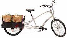
Core Recruiter: The Bike
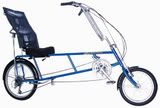
To get improved mode share for cycle-and-ride transport, there needs to be infrastructure support. As was discovered in the first bicycle boom at the turn of the last century, effective bicycle transportation requires paved roads ... dirt or gravel roads are not nearly as ineffective. Luckily, most of outer suburbia is equipped with a suitable network of bike paths, connecting to each household in the area ... these bike paths are called "streets". So the infrastructure is already in place.
Some cyclists on arriving at the station will bring their bike with them on the train. However, others will require parking, and a generous amount of both cycle-post parking and cycle lockers must be provided.
The greater range of the bicycle means that it can provide a useful supplement to pedestrian traffic, even if only a relatively small share of the population adopt it. Taking 5 times the pedestrian recruiting range as the core bicycle recruiting range gives a radius of 1.25 miles ... the ring from a quarter to one and a quarter miles is about 4.7 square miles, or 3000 acres. With half acre blocks, that is 6000 households.
Even without infilling, if bicycles can gain a mode share of 5%, then that adds 300 households to the self-powered recruiting range of the station, more than 15% on top of the core pedestrian households ... raising it to over 1,800.
Further, the effective range of the bike is dependent on the strength of the rider. Assuming the same 5:1 ratio for the outer recruiting zone, then the outer recruiting "ring" is 1,600 acress, or 3,200 households, plus, with half acre blocks. If 1% of transport mode share was taken up by these "strong riders", then that would push the effective non-motorized transport market to over 2,000 households.
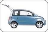
Core Recruiter: Neighborhood Electric Vehicles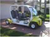
This core recruiter is newer technology than the more than century old bike, and the Shanks Pony from as long as we have been around (how many millenia is, of course, is subject to some debate among the Republican Presidential candidates) ... but in the niche of getting around complexes, sprawling stadium parking lots, and similar tasks, it is a well established technology.
Neighborhood Electric Vehicles have a substantial part of their niche defined by the National Highway Traffice Safety Administration definition of a "low speed vehicle":
low-speed vehicles (as defined by the National Highway Traffic Safety Administration) are capable of up to 25 mph. Low-speed vehicles must have seatbelts, windshields, turn signals, headlights, brake lights and other safety equipment that golf cars don't require. NEVs are designed to be used in residential areas with low density traffic and low speed zones. With a top speed of 25 mph, low-speed vehicles can be used on streets with a posted 35 mph speed limit or less.
NEV's are street legal on 35mph or less streets, but unlike bikes are not normally legal to operate on higher speed avenues and highways. This makes it important to ensure that there is access to the train station via a network of 35mph routes.
The train station can encourage the use of NEV's by providing special parking close to the station for ultra-compact vehicles, and providing a charge station were a driver of a NEV can park&plug&ride.
Assume an average operating speed of 20mph, and a core recruiting radius of 15 minutes ... or 5 miles. With half acre blocks, that gives more than 100,000 households in the core recruiting radius. Turn 1% of those on to NEV's, and that is up to 1,000 additional core market households ... turn 5% on, and its up to 5,000.
Variety, of course, is the hallmark of a focus on high energy efficiency, since one-size-fits-all tends to be one-size-wastes-always. Also lying within this general niche are electric bikes and communities including a dedicated alternative path network for golf-carts.
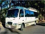
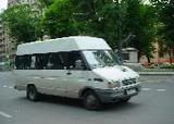
Core Recruiter: Local Bus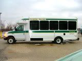
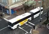
Of course, some people are not in a position to walk a quarter mile to the station, and we will be building up both cycle-and-ride and park-plug-and-ride use of the HSR station over a decade or more to get the types of mode shares described in those sections.
Meanwhile, the first resort for providing an alternative to cars in outersuburbia is bus service. From personal observation, this is presently very heavily biased toward a mix of college, very low income, and wheelchair riders, but our experience in the US seems to have been that bus ridership can shift toward the mainstream as gas prices hit unaccustomed levels.
And it is in this respect that local buses and a HSR station can often be the best of friends. Part of the very successful re-introduction of commuter rail to Perth, Australia, was a system of short local bus routes tightly integrated to the service schedule at the local rail station. For some reason, people that would not dream of getting on a bus to go shopping will not blink twice at hopping onto a bus for a five minute ride to the local station.
I'm not sure why the stigma associated with riding the bus is so easily waved off with, "I've got a train to catch". This may be mysteriously connected to the psychology in which someone over the age of 30 riding a bus to get downtown is a failure (to specialized Maggie Thatcher's famous turn of phrase), but a fifty year old in a suit and tie will readily hop on a downtown free circulator bus in distinctive livery to get to a lunchtime eatery.
On the one hand, the local bus has a greater top speed than the NEV ... but on the other hand, there is scheduling leeway required if it is going to arrive reliably in advance of the departing train. So as a rough guestimate, I'm happy to take the 100,000 houses in the radius of the LEV, and aim for a similar 1%-5% mode share in people who would use the bus to reach the HSR station.
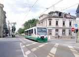
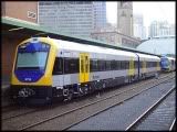
Core Recruiter: Local Rail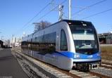
A major advantage of local rail is that it can often share the HSR station, allowing on-platform transfers between the HSR and local rail. Local rail that does not run on standard rail can normally be integrated comfortably with dedicated transfer stations.
Of course, one of the benefits of local rail is that the local core recruiter net surrounding the HSR station can be replicated around each of the stations of the local rail system:
* Each can be zoned for a donut of higher density stacked townhouse housing surrounding a mixed commercial/residential core
* Each provides the center of a wider ring of cycle-friendly access to the station
* Each provides the target for NEV's in the vicinity
* Each provides an traffic driver and interchange anchor for a system of short, local bus routes.
Of course, the
Route Matrix Revolution applies to local rail at the HSR stop as well. If one local rail line is along the corridor that is carrying the HSR, then the HSR station is a natural location for another local rail to intersect from a different line of travel. The local transport centers focused on a local rail station can radiate out from the HSR station in multiple directions.
New Recruiter TechnologiesOf course, these are just established technologies. There are a number of new transport systems coming down the pike that could serve as effective recruiters for HSR stations, but there are three that I would like to single out for mention.
Pluggable Hybrid Electric Vehicles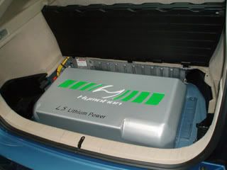
Regular HEV's gain two advantages from the battery-electric component of their drive train. The first is the greater efficiency of running combustion engines at a steady pace, and second is the energy recycling from recapturing energy while breaking that can be used again when re-starting.
Pluggable hybrid electric vehicles also gain from the greater energy efficiency of all-electric traction and from the cost savings available when buying electric power off-peak ... but only for the portion of the journey that takes place on stored electric power.
This means that if the normal drive to the station and back, plus sidetrips, falls within the normal all-electric range of the PHEV, the HSR station offers a natural complement to reliance on the PHEV for local driving. Just as with NEV's, this can be extended further and made sticker by providing park-and-plug-and-ride parking, in which the HSR user would pull in, deposit funds or leave an authorization for the electricity stored by the car, and head off to catch the train.
Aerobus / Elevated Suspended Local Light Rail
I have mentioned the Aerobus system previous, in
Retrofitting Outer Suburbia. In essence, the system involves laying light rail on suspension cable, with the vehicle consisting of a passenger compartment suspended below an enclosed pod that contain the motors and wheels. This allows for a suspended vehicle with capital costs similar to a light rail vehicle installed into an already available right of way.
This system never got beyond pilot test status in the West, but its cost advantages and the relative simplicity of crossing water with the Aerobus has won the company two contracts in China ... one in a "Three-Rivers" urban setting, and another to connect an island city with the neighboring mainland.
This is an especially appealing option for providing a local rail system that cuts across the HSR corridor, where there is no suitable Right of Way available. Individual pylons about 600 feet apart provides for the lowest capital costs, but if there are tricky clearances, its possible for individual pylons to be up to 2,000 feet apart.
Running an Aerobus system across a rail corridor would allow an Aerobus island platform to have direct ramp / stairs / escalator and elevator connection to two or more rail platforms underneath. Since it is common for major employment centers like Hospitals, Universities, Shopping Malls and Office parks to be located at some distance from existing rail corridors, and an Aerobus system can provide service closer to the door than the average car in the parking lot.
Rail/Bus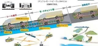
This vehicle, being developed in Japan, functions on the same principle of track maintenance vehicles that can get around track breaks by driving on the road. It has rubber wheels for running on the road, and steel wheels for running on the track. A short access siding would normally be the only new infrastructure required.
This, of course, can get over the passenger home side of the "door to door" equation, allowing a service that a passenger could book to stop in front of their house, to be let off directly at the HSR station platform. It is also appealing for small towns that have grown away from their original rail-orientation ... instead of bringing a new rail line to the people, bring the people to the existing rail line.
On-call mini-bus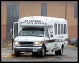
This core recruiter was brought to my attention by
das monde, who diaried on it on 31 January (2007) in
A transport service to reduce CO2 emissions.
The On-Call mini-bus combined the conventional
Dial-A-Ride with an on-call taxi service. The conventional dial-a-ride simplified the logistics of the process with notional routes served by the dial-a-ride service and lead times of a day or longer. The On-Call mini-bus uses modern logistics mapping and GPS tracking technology to create the bus route on the fly, in response to demand.
From the user perspective, the next available service or service with a target pick up time will be available from mobile phone or internet, or by conventional telephone ... and the bus service can automatically inform the user of when the service will be picking up by SMS or email.
Your TurnNow I throw the floor open. What are your ideas for effective Recruiters for HSR system ... and, yes, irrespective of my framing of this as a hypothetical outer-suburban HSR station, you can place your HSR station where you like ... in the middle of downtown, in a traditional cross-roads small town, or even, if you wish, in a tunnel station underneath the main terminal building of the international airport.
 ... for Progressive Populism ... for the Arc of the Sun ... for the Next American Revolution ... for Living Energy Independence ... for a Brawny Recovery ...
  For the Daily Kos edition of this essay, I wrote:
 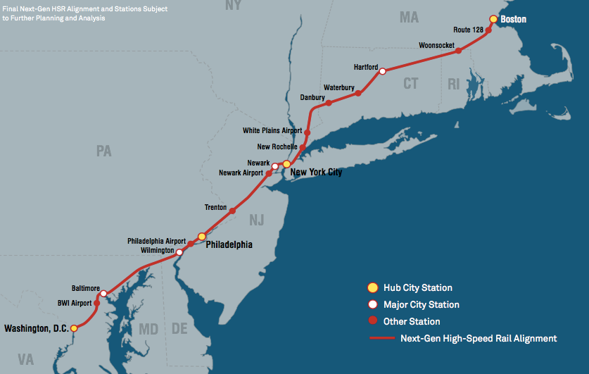 For those who missed last week's Sunday Train, the "Next Generation" proposal aims to build on the NEC Master Plan to provide Express High Speed Rail service in the Northeastern region, from DC to Boston via NYC.
 In the Northern alignments, there are three strategies for getting out of New York City:
  There are a similar set of southern alignments, but I expect that the alignments to the east of the NEC can be set aside, which leaves the main contenders as being the "Allegheny" alignment and paralleling the existing NEC. Note that for the Allegheny alignment, the Emerging HSR Philadelphia/Harrisburg or "Keystone" corridor takes on added significance, since a Semi-Express could run NYC/Philalphia and then onto the Alleghany Express HSR via the Keystone corridor.
 Further, the Keystone corridor could be used to connect the (informal) Appalachian Hub to NYC. Long time readers will recall that one backbone of the Appalachian Hub is a Steel Interstate on the Shenandoah Valley & Tennessee corridor. From the northern end of this backbone at Harrisburg, a service could continue down the Keystone corridor to the Alleghany NG-HSR corridor at Westchester PA (see map) and then on to NYC.
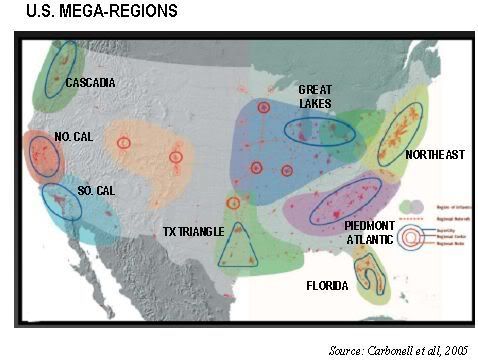 As already suggested above, the choice of alignment in the Northeast can affect how easy it is to integrate into the Express HSR corridors from outside of the Northeast. And the map of potential emerging Mega-Regions in the United States gives one indication why that is important: the Great Lakes / Midwestern Mega-Region and the Piedmont-Atlantic Mega-Region are immediate neighbors to the Northeast, and at distances where Express HSR is a viable competing transport option under current energy prices ~ and where even 110mph Emerging HSR will be a viable competing transport option at the energy prices that we may well see in the decade ahead.
 A few weeks back,
 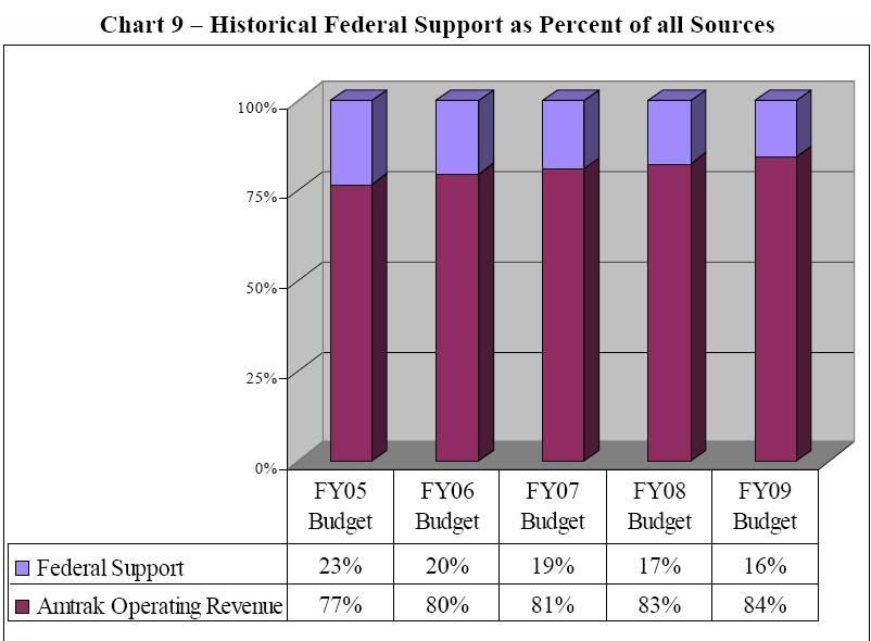 Of course, the SubsidyScope analysis further confuses the issue by headlining subsidy per passenger, rather than subsidy per passenger-mile. This is, of course, absurd: it treats trips from Harrisburg to Philadelphia, from Washington DC to New York, and from Chicago to Seattle as each delivering identical "travel" benefit.
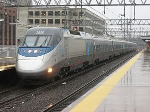
 The State Corridor and State-Subsidized Routes
 The Long Distance Services